Farmstead #4 – YMCA Day Camp
This farmstead is probably the most familiar to people who have visited the park or were associated with the YMCA. The farmhouse was the last surviving remnant of the nine farms that existed on the Bertram property until is was torn down in 2018. This house was the home residence for several of the YMCA caretakers who took care of the property from the early 1960’s until 2012 when the property was sold to the county and the city. For a couple of years, this farmstead property was the temporary sight of the YMCA Day Camp until the YMCA built their new facility.
It has been hard to locate names of past residents of the property due to the fact that it lies on the edge of two sections, #17 and #16. The first names to appear were in 1859 to William Parvin & John Parvin, possibly brothers or father & son since William’s name appears first on the Warranty Deed. Another name was Arnold & Helen Fernberg, 1901-1950.
As you may recall from an earlier tidbit, this farmstead has some national notoriety. Some time in the 1990’s, the well-known author Clive Cussler wrote a book entitled “Valhala Rising” about the Vikings in North America. It’s more of an adventure novel but it does touch on the history of the Vikings and a “possible” adventure to Minnesota. In the novel he mentions finding a rune stone on the shores of Bertram Lake in Monticello, MN. He mentions the old barn as being the working office of a historical researcher and tells of the land gently sloping to the lake.
The new chalet is part of this property, as well as the machine shed and garage built by the YMCA. This garage was built for the mini bike program created for troubled youth.
Farmstead #3 – Worthington/William Kiebel
This farmstead out of all the other eight farmsteads is probably the best known for many reasons. The farm buildings themselves were located atop the rise 1/8 mile above Bertram Lake. The site of the building was just west and east of the road leading to the current turnaround. It was just west of the new YMCA Day Camp, and consisted of a house, large barn, hen house, two machine sheds, and a grainery. The house was surrounded by lilacs and locust trees which are still there today. Access to the farm was a long driveway north to County Road 39.
As with Farmsteads #1 and #2, the land was originally granted to John D. Taylor in June, 1957. The current parcel was deeded to Daniel Worthington in 1877, then to his son in 1889. In 1901 William Kiebel began purchasing the land including the parcel at the north end of Long Lake (NW corner Section 16 and SW corner Section 9). This is where the new Long Lake overlook is located.
I mentioned earlier that this farmstead is probably the best known of the nine sites because of the historical importance. Below are a few reasons:
- This property provided the easiest access to Long Lake during the winter months. It was Long Lake that provided the purest water and thus the purest ice for the ice boxes of Monticello residents. Ice blocks were cut for many years there.
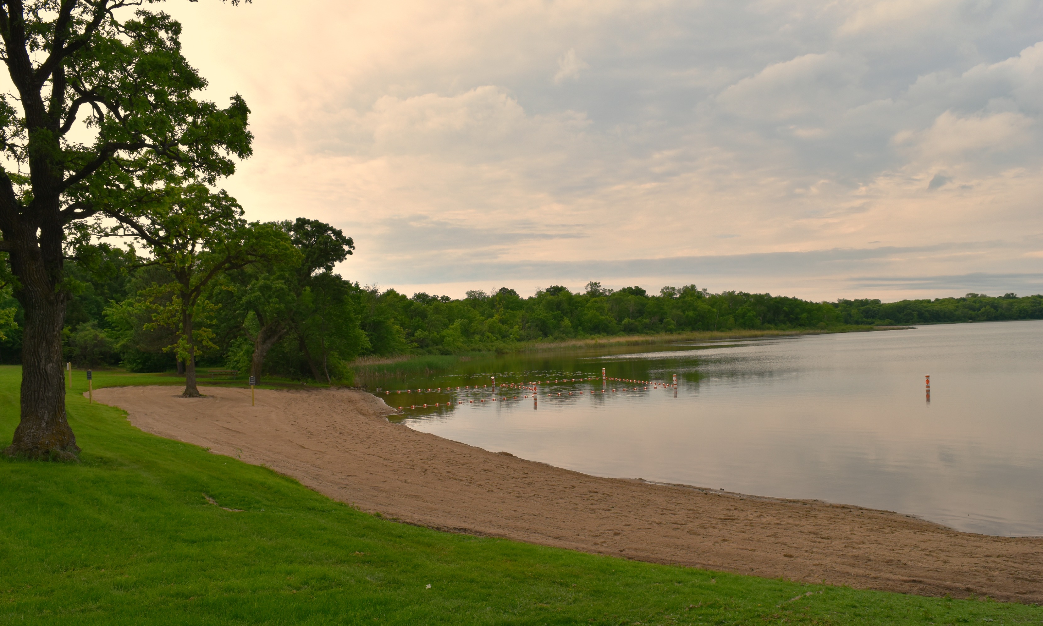
- The beach on Bertram Lake provided the only access for many years for fishing, swimming, camping and picnicking. Many parties and reunions occurred under the oaks at the beach. Prior to the 1851 land purchase, the beach area at Bertram was a stopover spot for Native Americans traveling through the area.
- Currently, as in the past, the land by the beach provides a crossroads for the bike and hiking trails, as well as other activities throughout the park.
Farmstead #2 – Outhoudt Family
The land for their homestead was originally included with the land granted in 1857 to John Taylor. Some of the notable owners of this farmstead include:
- 1870-1900: E.J. Beedy Family
- 1910-1945: Marcus Wildman Family
- 1945-1963: Lehigh Cement Co.
- 1963-2010: YMCA
The last known name associated with the farmstead was the Robert (Bob) Outhoudt Family. They did not own the land but they lived on the property. It’s possible they did some farming, maybe dairy and other animals, but in general the land was not very suitable for crop farming. The land was located off County Road 39 to the north and continued south to Mud Lake. East of the property the land was wooded and to the west the land abutted prairie/crop land.
The property itself was hilly with glacial depressions, not suitable for farming, dropping to the south to Mud Lake.
In the 1960’s, the YMCA planted pine trees on the land for potential sale as Christmas Trees in the Twin Cities area.
Farmstead #1 – The Wildman’s
Minnesota became a state on May 1, 1858, but the distribution of land began after the Traverse des Sioux Treaty of 1851. To facilitate this, counties were established as the population grew. Wright county was formed in 1855, and much of the land began to be distributed and recorded. Since Monticello was selected to be the county seat, as the most populous city, the land around it began to be distributed early. The nearest property of the Bertram Lakes land was along County Road 39 in the NE corner, Section 9, of Monticello Township.
The very first name on the abstract to be listed as the owner of the land was John Taylor, dated June 23, 1857. I will try to present owners every 25 years to show transfers of the land to other owners:
- 1884-1895:King Staples (interesting name)
- 1895-1905: Charles Beedy (wife, Sadie) during this time Sadie became the sole owner of the land, which was a rarity!
- 1910-1946: Marcus Wildman & Family
- 1945: Lehigh Cement Co.
In 1945, the Lehigh Portland Cement Co. granted a right of way to Standard Oil Co. to lay, maintain, inspect, operate, replace, change, or remove a pipeline for the transportation of gas and oil.
The last listing in the abstract shows a date of October 17, 1963, at which time the YMCA of New Hope became the owners. The Lehigh Portland Cement Co. placed a stipulation on the land that it be used in its natural setting and at the time it fit the YMCA’s vision as a day camp.
The farmstead (house, barn, siloh, etc.) existed on the rise about 1,000 feet south of County Road 39. The foundation of the barn still exists today, just north of Otter Creek which flowed through the property. The creek was the farm’s source of water until a well was drilled later.
Red Caboose? What Red Caboose?
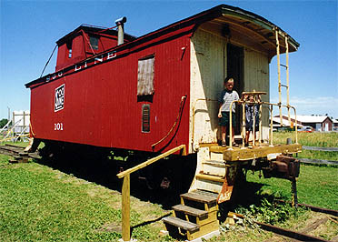 Someone recently asked me if there was a caboose (a red one) once located on the park property. I can say that yes, there was! Before I talk about this, though, I must first mention a little history.
In railroad history, a caboose (usually red for a reason) was located at the end of all trains. It was the office and sleeping quarters for three of the railroad workers, one conductor, the brakeman and the flagman. All of these workers had very specific jobs designated by their names.
With the advancement of technology in the 1970’s, trains began braking and signaling electronically. in 1982, the Railway Labor Act directed railroads to begin eliminating the cabooses where possible to do so, but in the process it also eliminated jobs.
Still, the popularity of cabooses was very high and many people did not want to see them go to waste. The idea arose to put them in parks and playgrounds, whenever and wherever possible. Because of this, one was donated to the YMCA in the early 1980’s and placed near the old day camp facility of of 90th Street. It was located by the forked path that leads to the dam and the esker. A playground was located by it named Arrowhead Playground. The day camp kids loved it!
The question always arises, just how did it get there … but I can’t talk about that! As far as to where it went, it was donated to Pioneer Park in Annandale.
So yes, Virginia ~ there was a caboose at the park!
Going on a Nature Walk
Since we began this adventure in 2006, many people have stopped to tell me that they love to walk through the Bertram Lakes property. When asked to describe their experience in one word, they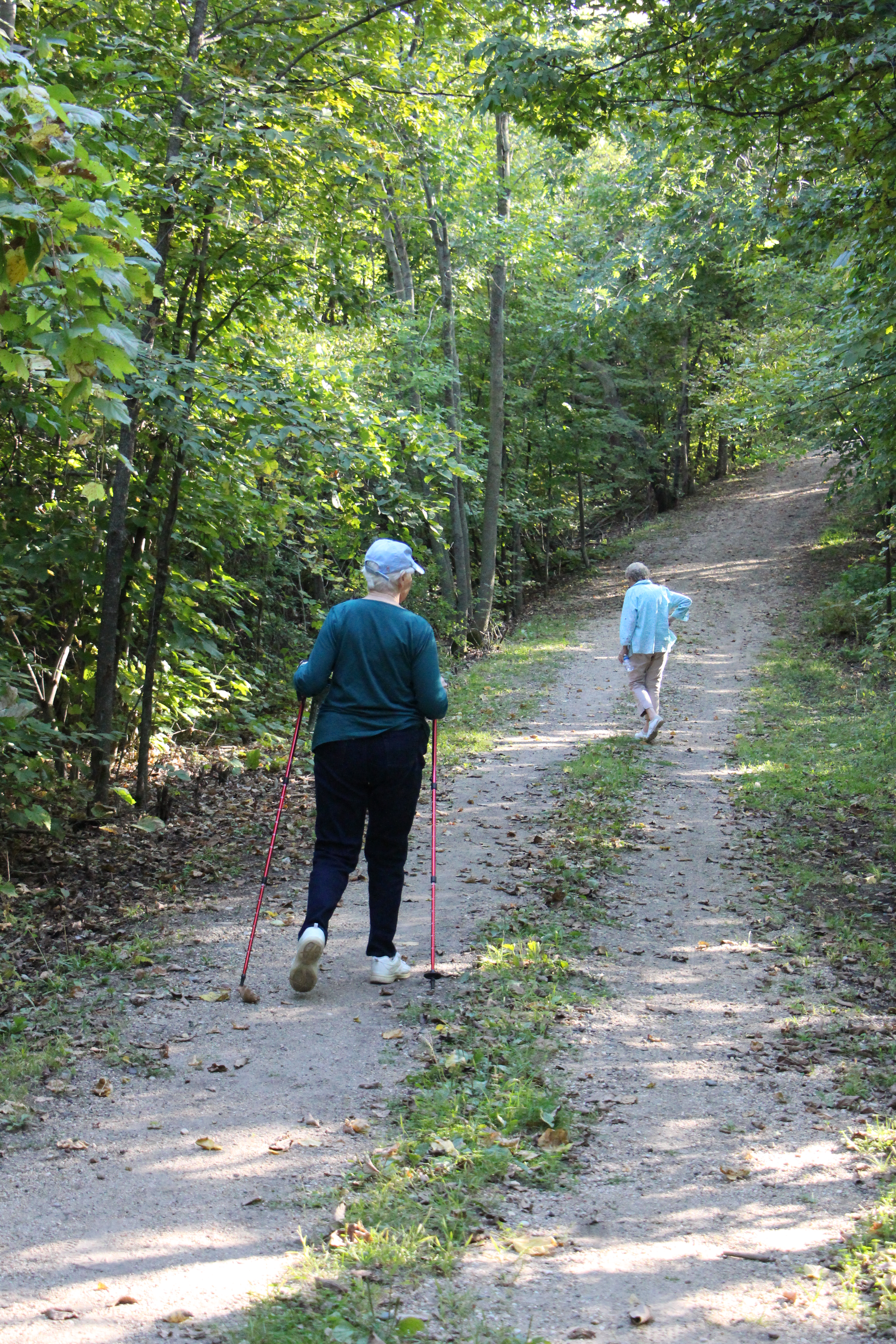 will say, “quiet, serene, beautiful, enjoyable, exercising, still, and renewing”. But … there are some rules to follow:
- Walk slowly.
- Spend 80% of the time looking up and around (unless you are looking for wildflowers or mushrooms).
- Open up all your senses, smell, see, hear, and feel what is being presented to you.
- Rest on a rock or stump and take in everything around you.
- Be aware of animals, birds, insects, trees, flowers, etc.
- Always check out something new.
There are many benefits to going on a walk through this beautiful property, some of which include:
- Relaxes the mind and body.
- Lowers stress, depression and anxiety.
- Increases attention span and memory.
- Provides exercise for the mind, body and spirit.
- Slows down our everyday pace.
- Gives us a peaceful feeling.
When going on a nature walk at Bertram park, here are just a few interesting things to look for:
- Glaciation: The park has three very special areas to be aware of,
- The “FEN”: A glacial lowland, a marsh located at the north end of Bertram Lake on the other side of the playground.
- The “KAME: A higher piece of land east of Long Lake. This is a perfect place to watch the emergence of the moon, planets and stars after sunset.
- The “ESKER”: Located between Long and Bertram Lakes, this high ridge of land is a perfect hiking area.
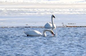
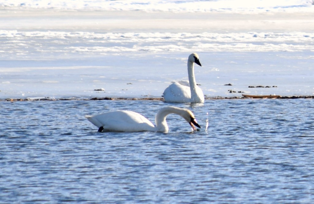
- Animal Life: Be aware of swans, loons, eagles, deer, beaver, and possibly river otter (for which Otter Creek is named).
- Flora: Trees of many varieties, wild flowers, mushrooms, etc.
Naturalist John Muir said it best, “in every walk with nature one receives more than he seeks”.
Whether it’s winter, spring, summer or fall, you’l always find something new to explore during your nature walks at Bertram!
Volunteers Needed!
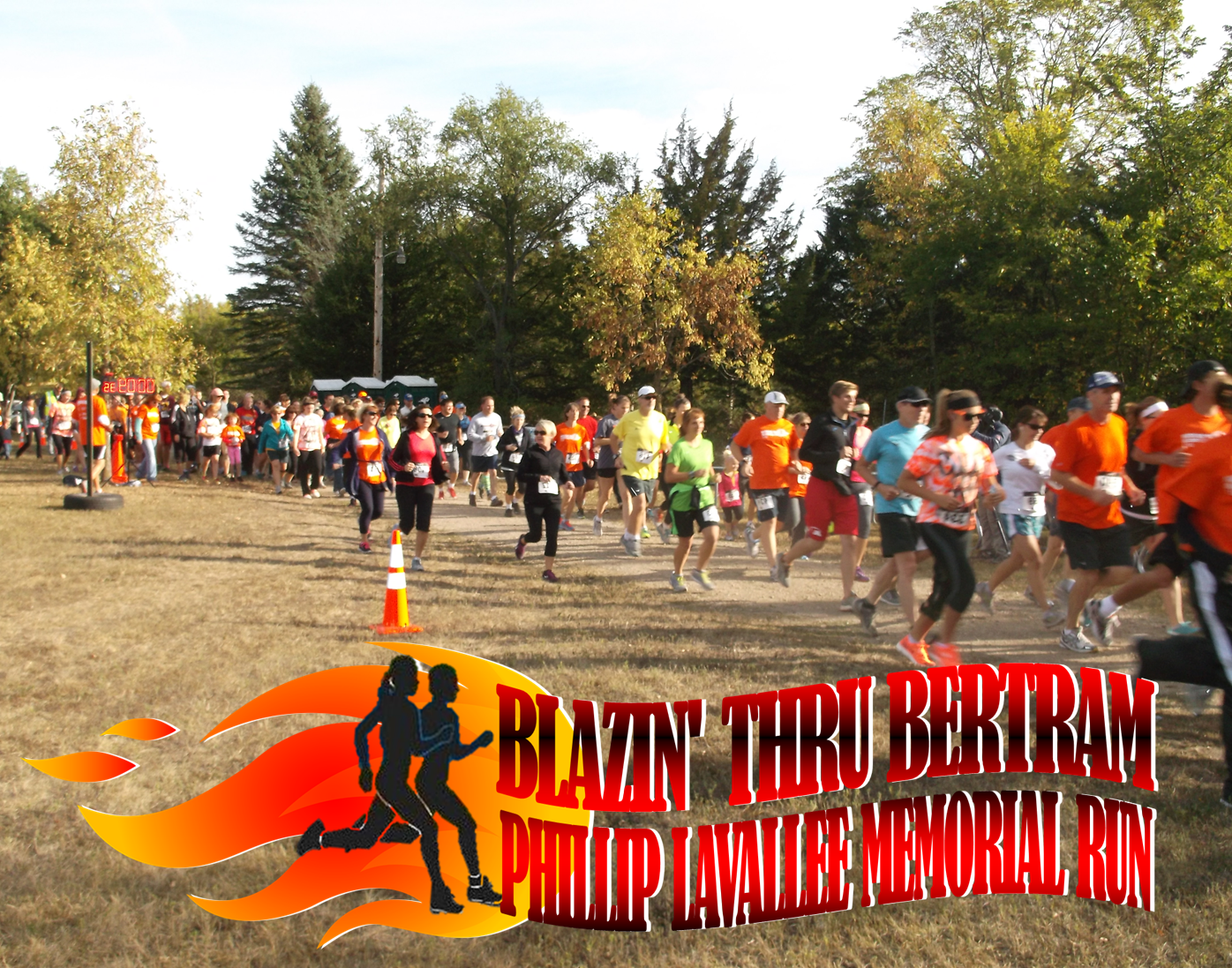
We have lots of volunteer positions we need to fill for the Triathlon.
If you can help, please email: friendsofbertram@hotmail.com.
Thank You!
Members Only Open House
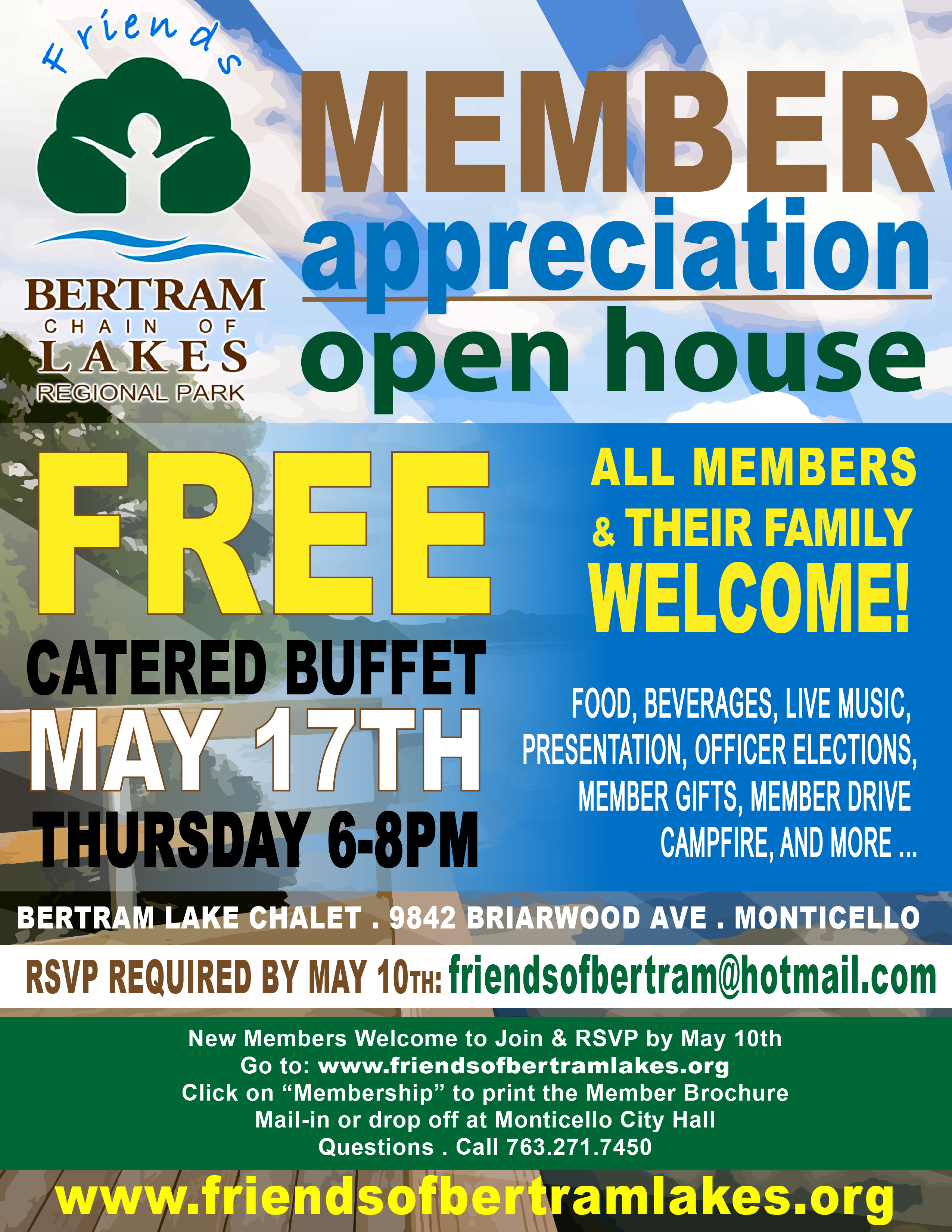
If you would like to participate in our Membership Appreciation Open House but are not yet an official Friends of Bertram member. Please join and RSVP by May 10th. click here to print the membership form and mail or drop at at Monticello City Hall. Thank You!
Schools II
I have mentioned before that there were two country schools that serviced the students of the Bertram Lakes Area 125+ years ago. One was the Hanaford Country School which was located on Cahill Avenue, a fifth-mile south of County Road 106. This school was open from around 1870 to 1952. Then students began attending Oakwood School in Monticello. The Hanaford Country School was torn down some time in the 1970’s.
The second school was the Prairie West Country School located along County Road 39 West, approximately two miles from the I-94 underpass. The school met its demise on March 10, 2018. I wrote a letter to the editor of the Monticello Times which reads as follows:
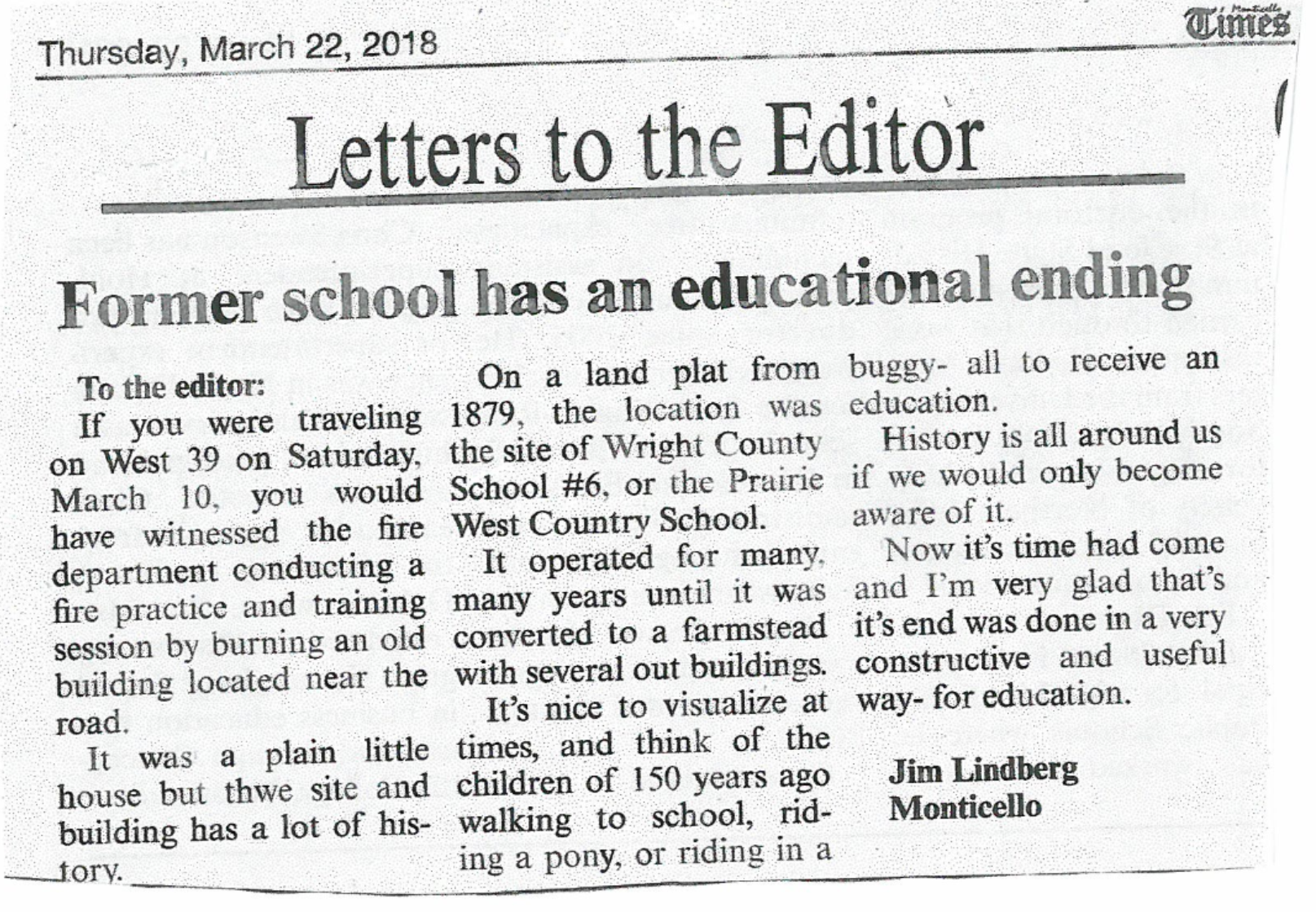
These schools represent a time gone by, yet they also show that they were important in the development of the area.
Pine Plantations at the Park
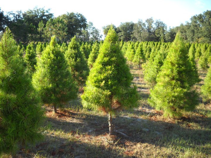 In an earlier tidbit I talked about the YMCA’s harvesting and sale of Christmas trees but I did not mention how this all came about. As the YMCA began purchasing land from the farmers surrounding the lakes, they also began talking about the creation of a Christmas Tree Farm to help them in their fundraising efforts. Since many of the fields were open areas (crops and pasture) they began massive plantings of seedlings of pine, spruce and fir to be used in the future as Christmas trees. The average time for seedlings to grow into usable Christmas trees is 7-9 years so the YMCA was very far-sighted in their plans. But in order to be the beautiful trees that people would buy for their families, the trees had to be groomed. This is a meticulous process that takes time and energy, mostly man hours because of the sheer number of trees. To accomplish the grooming, the YMCA had to use razor sharp machetes (knives) which were able to slice through the branches of the trees with ease.
Beginning in early June of each year, the YMCA would use the “knives” to top off excess growth from the year before. It had to be in June so the remaining branches could set the buds again for the new growth (usually 2-3 buds). In order to groom the trees, the men doing the work had to learn the proper way to prune the trees. Using the knife they had to make a sweeping motion from top to bottom following the angle of the tree to create the cone effect that was desired. They would work around the tree moving to the right and finish by lopping off 2/3 of the top spike. If the worker was left-handed, they would go left around the tree. The process not only created an aesthetically pleasing tree, but one with thicker branching (remember the 2-3 new buds).
The finished trees were usually harvested in early November each year. The men working had access to a bundling machine so they would put the tree through the machine which would compress the branches and encase them in a mesh for easier transportation. The Christmas tree harvesting went on for many years until the late 1980’s. After that, sales dropped due to the time, cost and commercialization of the Christmas tree business. The tree farm (or plantation) has since become mostly pine and new growth areas. In future years, the plan is to reforest some of the areas into the original Oak Savanna woodlands of the past. There is much to do to accomplish that transition.
The Source of Otter Creek?
A few months ago, I wrote about the importance of Otter Creek to the park. In that tidbit, it was stated that the creek’s source was in the swamp area southwest of Birch Lake. It was supposed to say the swamp area southeast of Birch Lake. But, by doing some further research and looking further into the archives at the Heritage Center in Buffalo, Minnesota, I have learned that this has not always been the case.
I located two maps; 1) An 1874 Andreas Atlas map; and 2) The Public Land Survey map of 1907. First, the 1874 map that shows three lakes – Bertram, Long and Mud as one. Otter Creek is shown running through all of the lakes as it does today, but it also shows something very different. Otter Creek is shown entering Bertram from the west but it then curves south, across 90th Street into North Cedar Lake and into Cedar Lake as its source.
Secondly, the 1907 Public Land Survey shows a similar pattern with one major exception – it shows Otter Creek coming into Bertram from the west but flowing through the swampy areas that exist today. It also shows the creek meandering from the south under 90th Street and coming from the Cedar Lake area. This map does not show roads but it is still easy to orient oneself.
So, the mystery continues ~ where exactly does Otter Creek begin?
• Has nature itself made changes?
• Have farmers and agriculture altered the land?
• Has technology in mapping improved?
• Are there other reasons?
Whatever the reason for the changes, we will always enjoy what we have.
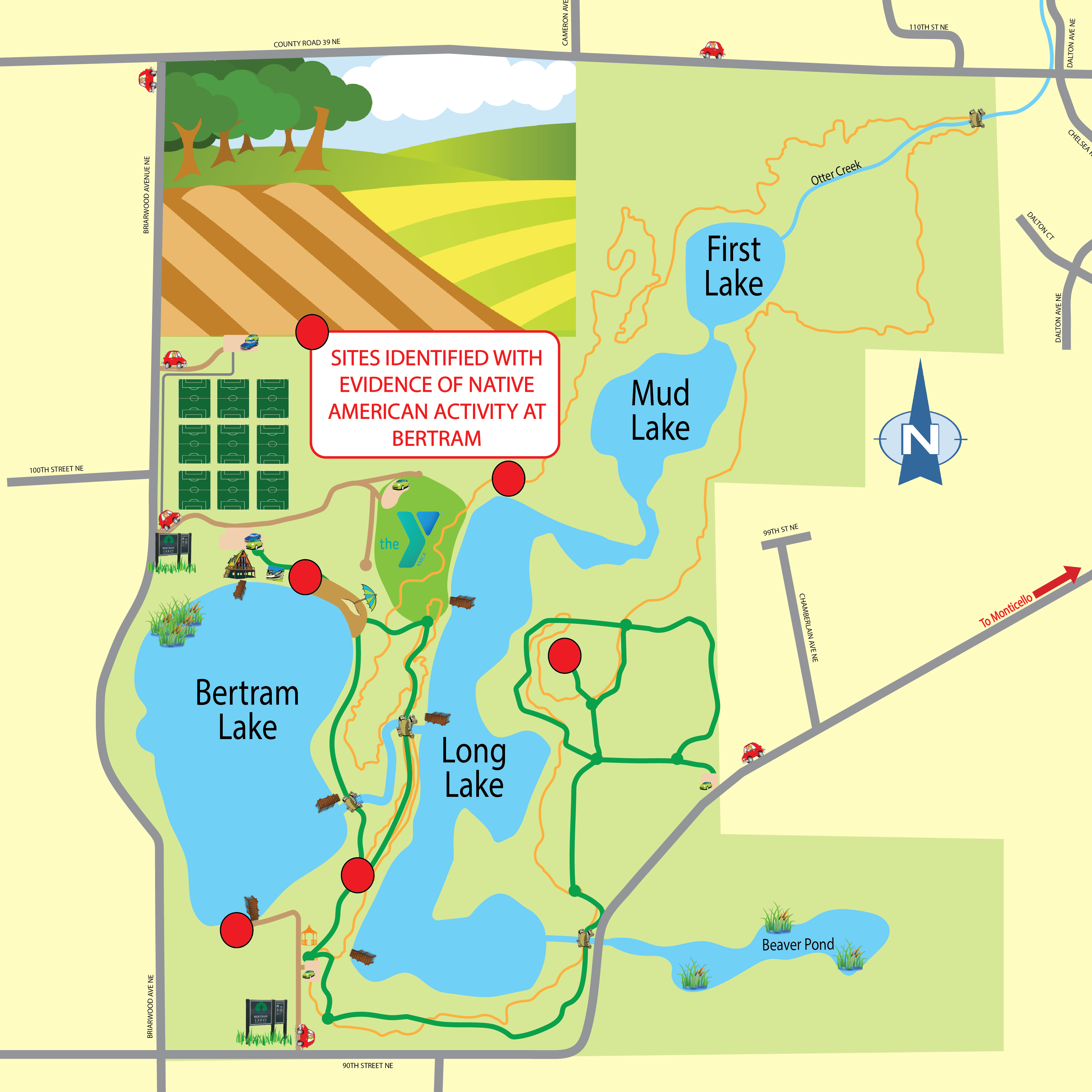
Native American Evidence at Bertram
 Many people have asked me if there was any evidence of Native American activity around the Bertram Lakes area and I can say that there was. In 2009, when interest in purchasing the area from the YMCA became apparent, the Wright County Parks Department contacted Trefoil Cultural & Environmental Heritage Group to conduct a study of the Bertram Lakes Area. Five sites were located, which I will talk about later.
I must first mention a little background on the Native Americans who used the area and why. One group was the Eastern Chippewa. I say Eastern because they were originally from the upper New York and Canada region but were slowly pushed west as the European/American expansion happened. Most settled in northern Wisconsin, Minnesota and Canada but did range as far south into the area east and northeast of the Mississippi River. Being hunters and gatherers who traveled by river, they had some influence along the rivers.
The major group who left their imprint on the area were the Sioux, mostly an extension of the Plains Sioux tribes, primarily Santee. The Sioux tended to be nomadic and moved about the land in a more random fashion. The most common element between the two is that they camped in their movements within 200′ of a water source. Thus, when the study of the Bertram Lakes property was conducted, five sites were identified around Bertram Lake and Long Lake. The sites noted include:
- The north end of Long Lake
- The beach area at the north end of Bertram Lake
- The south end of Bertram Lake near the boat launch
- The open camping area southwest of the old YMCA Camp headquarters building
- The east side of Long Lake on the Kame
In studying the sites, the shovel and sifting method was used. Small pieces of quartz, chert and some remains of pottery were found. All areas had some remnants with the exception of the north end of Long Lake. None of the sites identified qualified for the National Registry.
The results of the survey seem to indicate that this was a “move through” area where natives stayed for a day or two and then moved on. Although, far from being proven, it seems that the Esker may be been the main avenue of travel for the native populations but this is only speculation.
Click the link here to view a map showing the sites with Native American evidence at Bertram.
Friends Launch New Membership Program
The Friends of Bertram is a volunteer group devoted to preserving and enhancing the experience of the Bertram Chain of Lakes Regional Park. Through various activities and efforts we seek to sustain the natural beauty and ecology of the park, support interpretive and environmental educational programs of the park, advocate for the park, promote awareness of the park’s resources, and provide volunteers and support when needed. We need your help. Become a Friend today!
The Friends launched a new member program effective July 1, 2017. Your annual membership dues of $20 will help to fund various projects and events at the park.
To learn more about becoming an official Friend of Bertram, please click here!
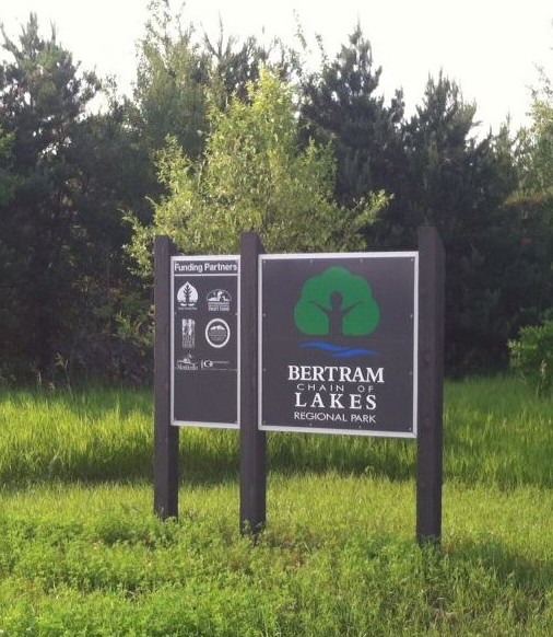
Chronological History of Bertram
If you have any information and can help us fill in the blanks, please send us an email.
Old YMCA Buildings
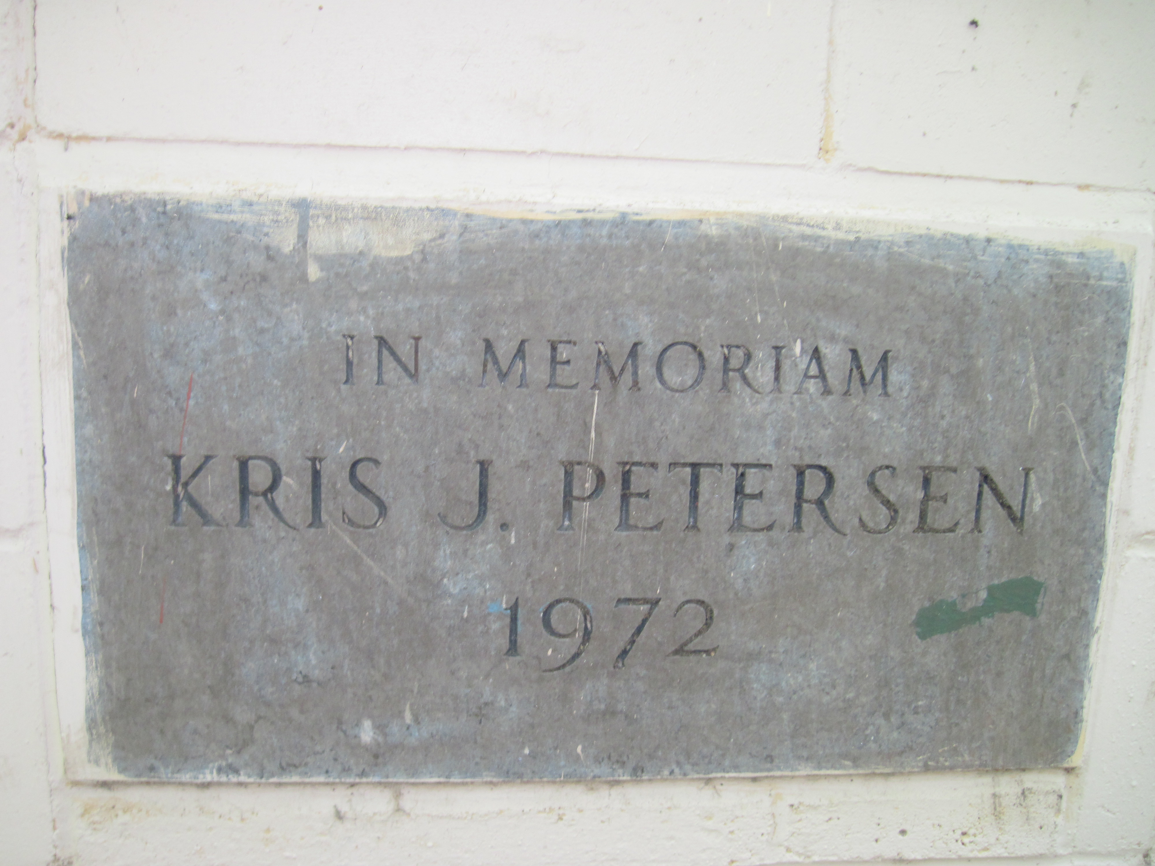
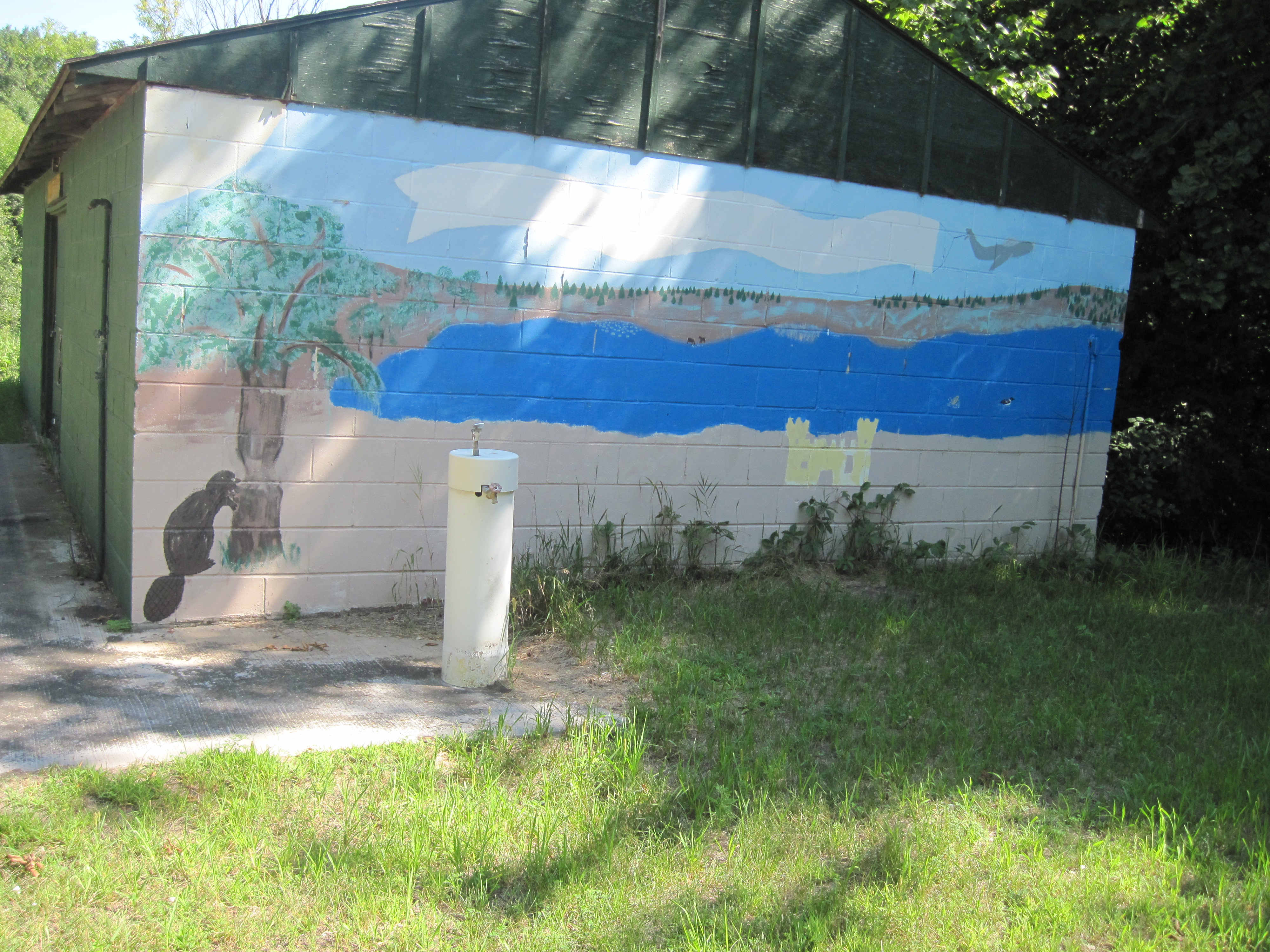
 The YMCA Camp Manitou has been in operation at Bertram Lakes since 1972. It was located at the south entrance of the current park for over 35 years and has served many thousands of kids with a great camping experience. But, as we all know, times change and two of the original buildings were recently demolished as they had become in disrepair. The “main building” and the “change house” were the buildings removed.
The change house was the place where campers would change into their swimsuits for their time at the beach. It was also used as a storage facility for the smaller sailboats on which the older campers learned to sail.
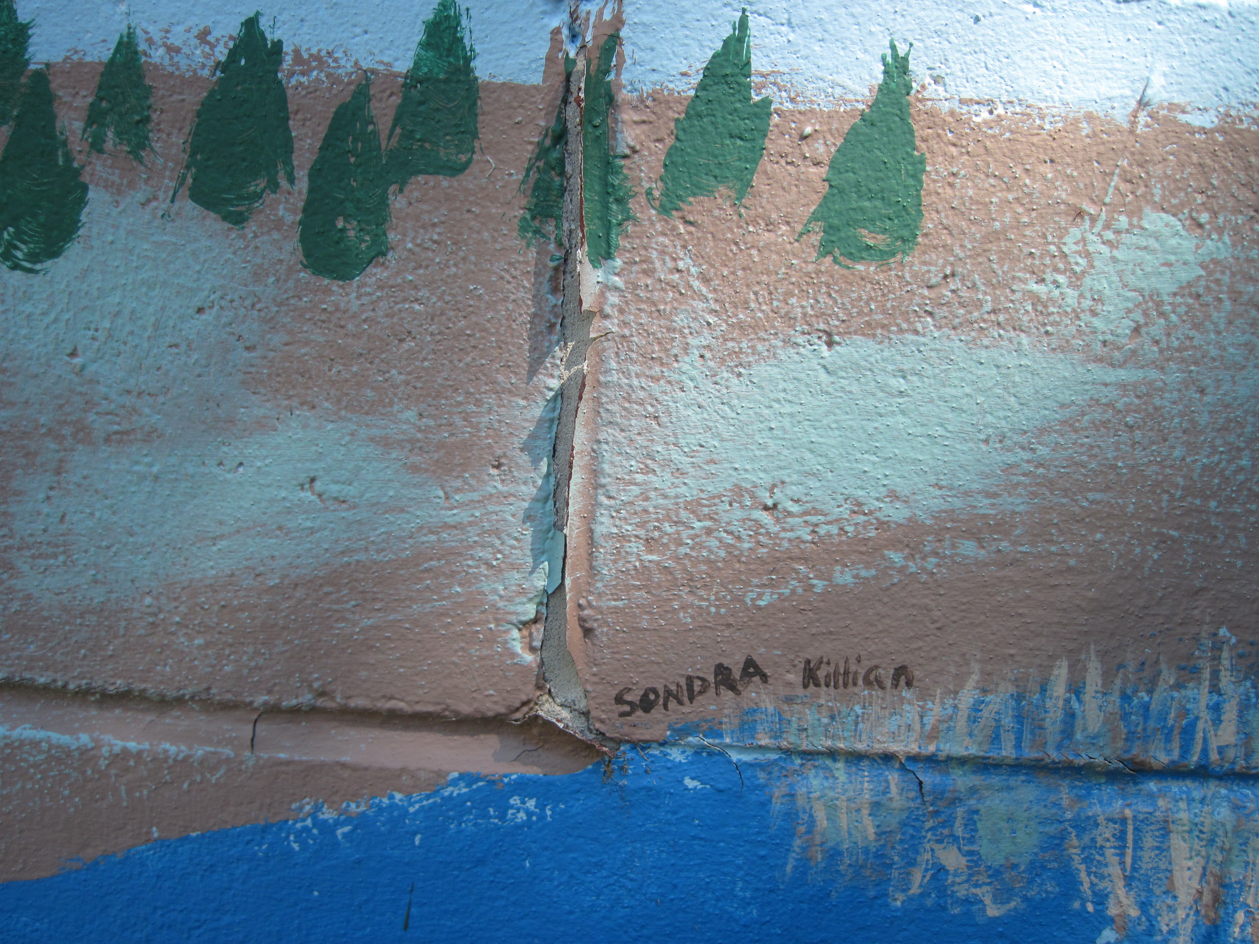
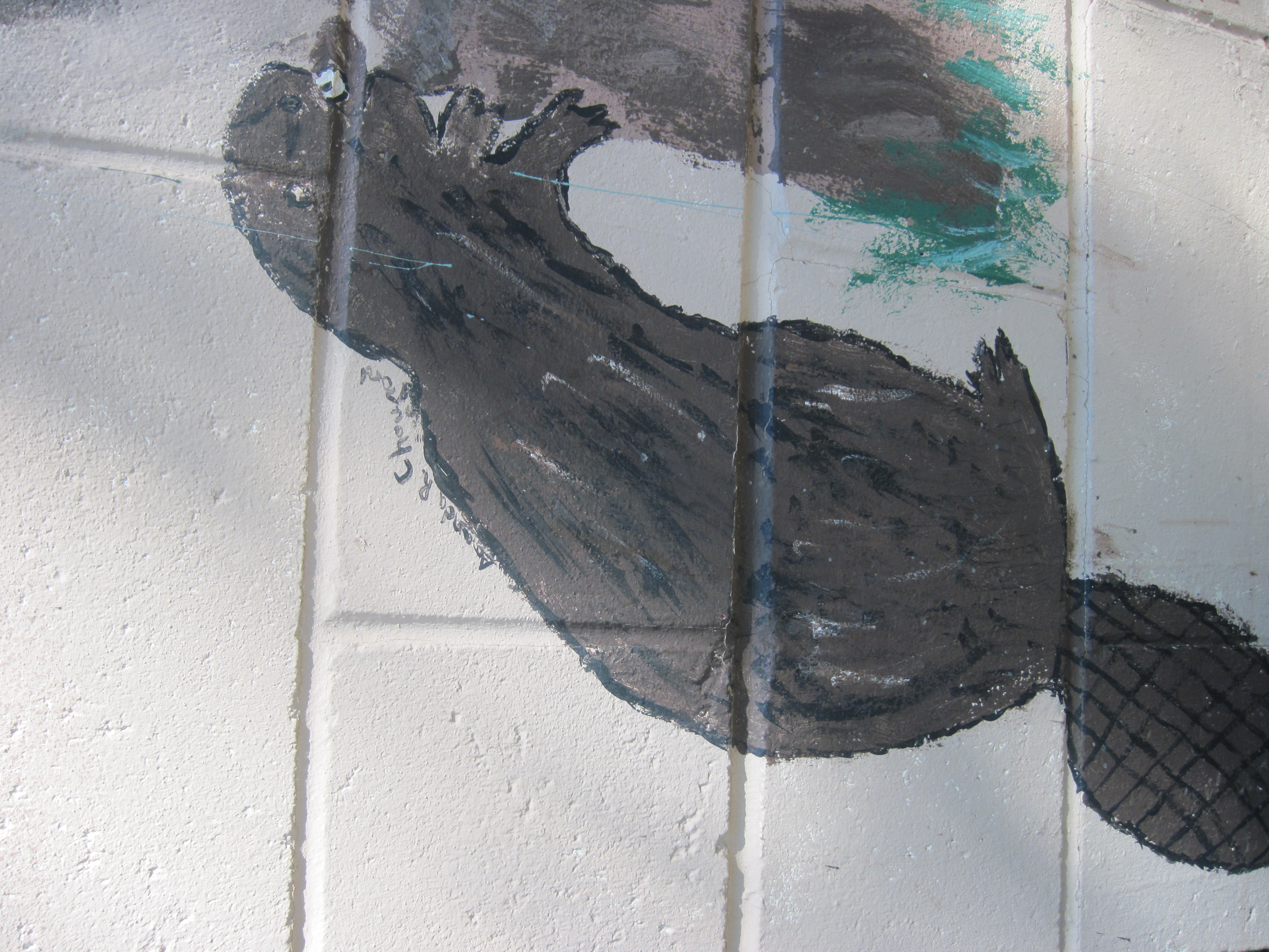
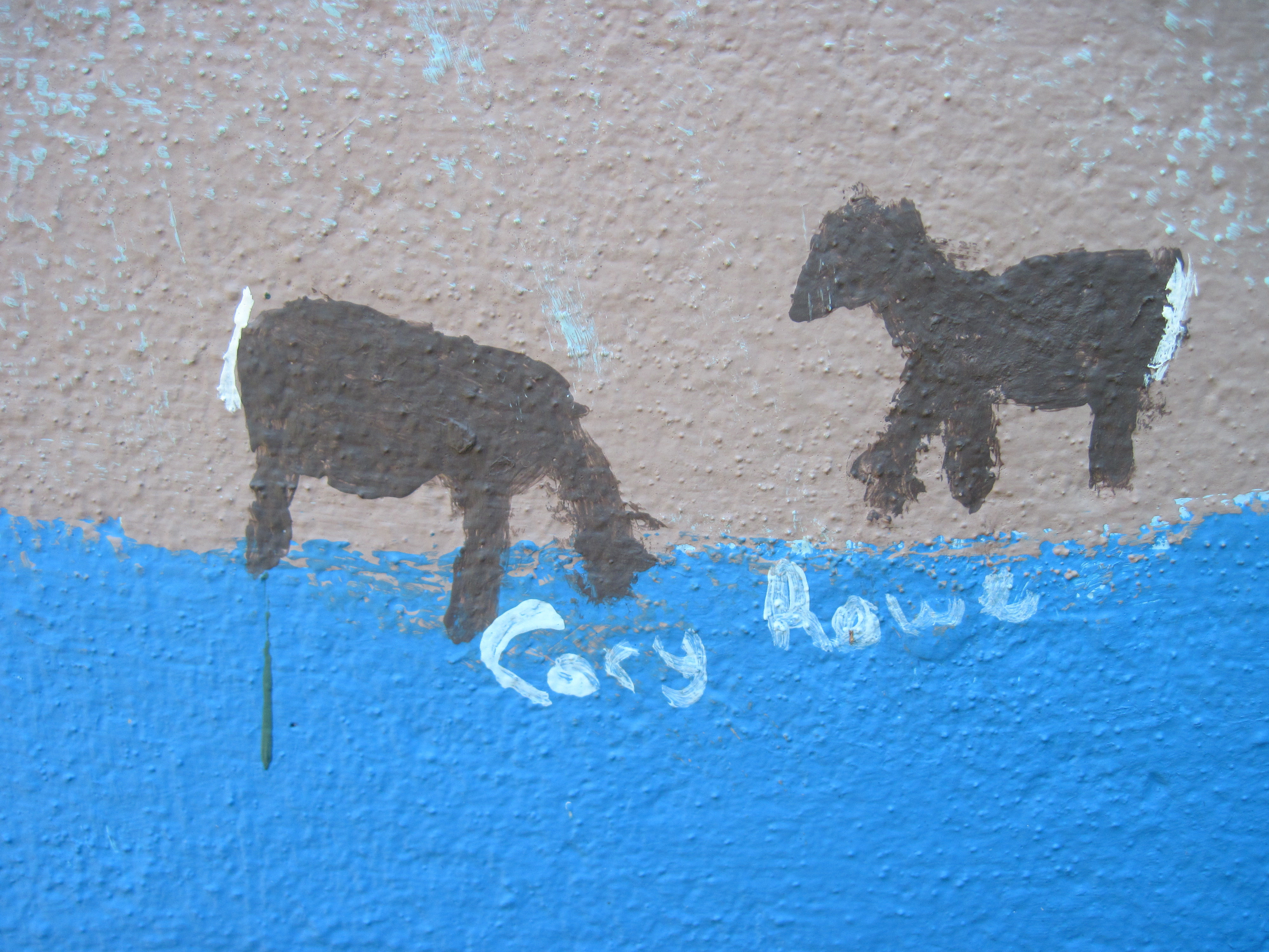
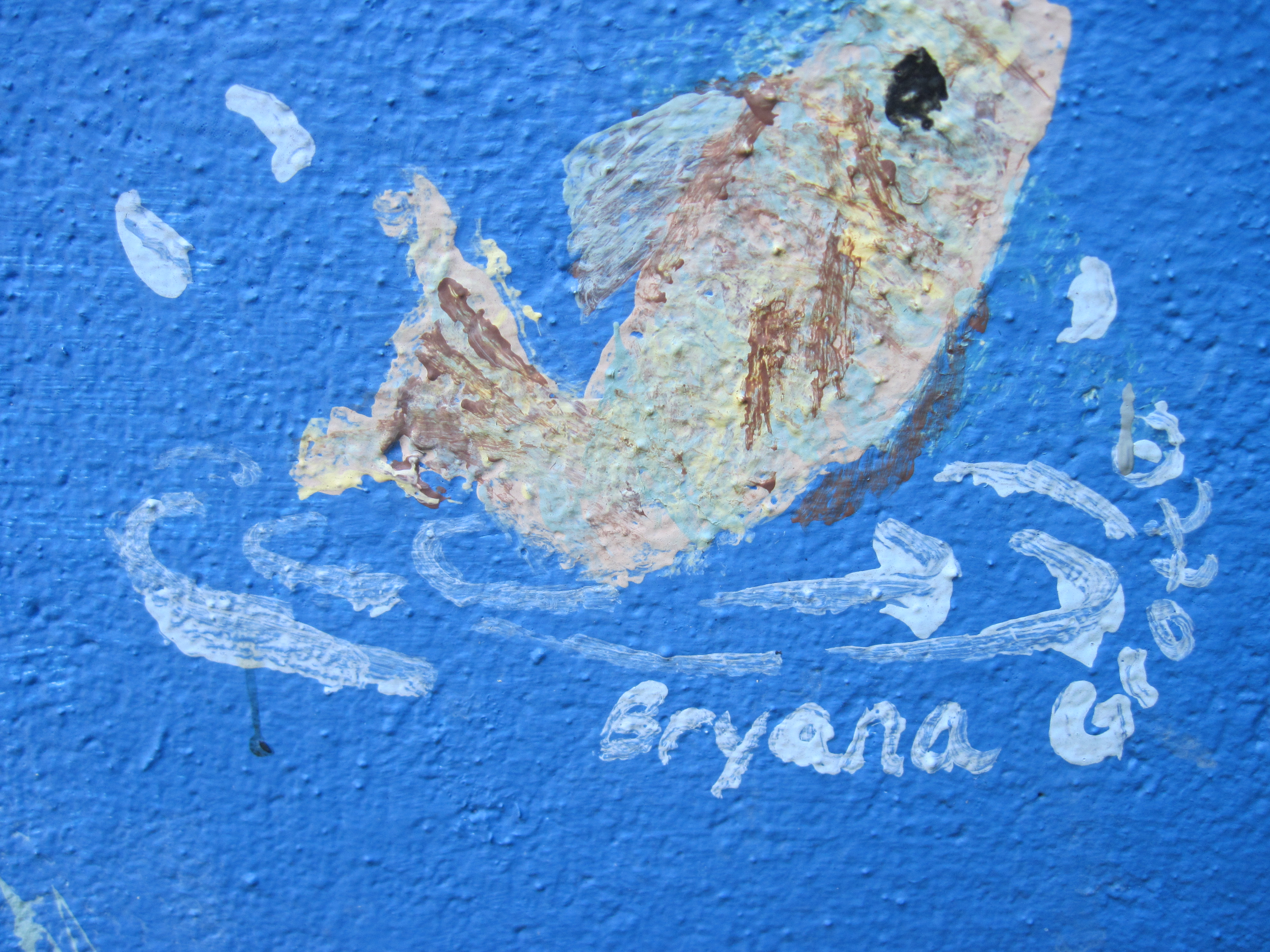
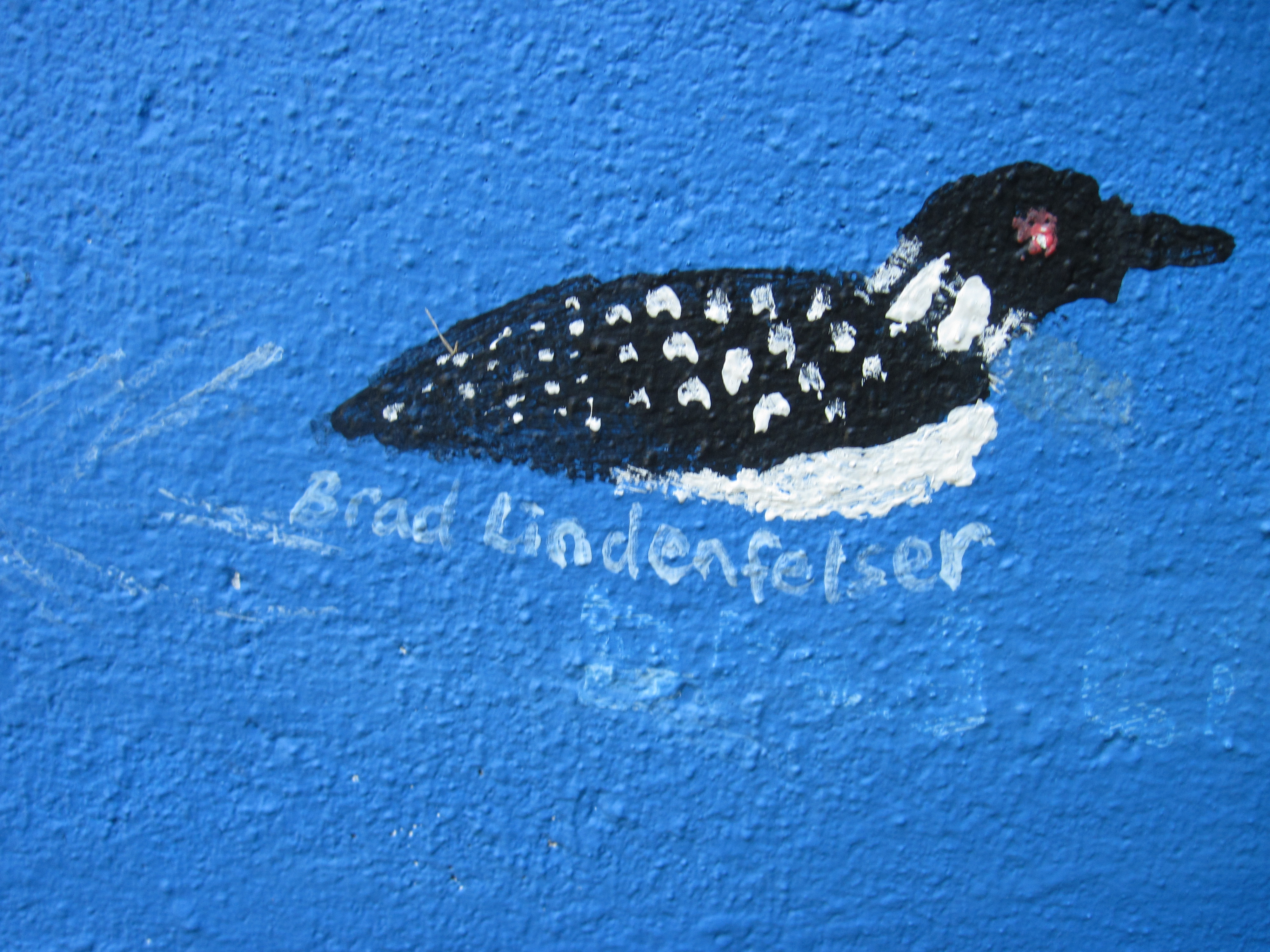
One year a group of campers decided to dress up the change house by painting the west end of the building. The scene was one of a lake (maybe Bertram) with pictures of some of the animals that inhabit the park ~ beaver, deer, loons, bass, cranes and trees. The only painting out of place is that of a castle. Each character had the name of the camper who painted it next to it. See the pictures in this tidbit.


The Witch Tree
 Halloween is the time of year when ghosts, witches and goblins appear to wreak havoc in the world! During the late 1990’s and early 2000’s, the staff at YMCA Camp Manitou created the “Trail of Terror” which would include ghosts, skeletons, goblins, witches, and zombies. The trail wound through some of the Bertram property where younger kids riding on a hay wagon would be “scared out of their wits” by the hidden Monsters! It became very popular among area kids and they would look forward to it each year as the leaves began to fall.
For many years, even today, because of the YMCA Camp, the area was referred to as Camp Manitou, a Native American name meaning “Mystical Spirit”. The Bertram Lakes have since become known for its mysteries as strange things have happened there. (See my earlier tidbit, “Hatchet Harry”)
One of these stores is in the form of a tree, the “Witch Tree”. The story is that of a witch who lived in and haunted the area in the past. She grew old but wished to live on, so she turned herself into a sturdy oak tree. She still haunts the woods today with her mangled arms and spooky warts!
I cannot tell you where she is because you need to explore and find her for yourself! When you find her, please take pictures to share, but “warning” don’t stand too close!
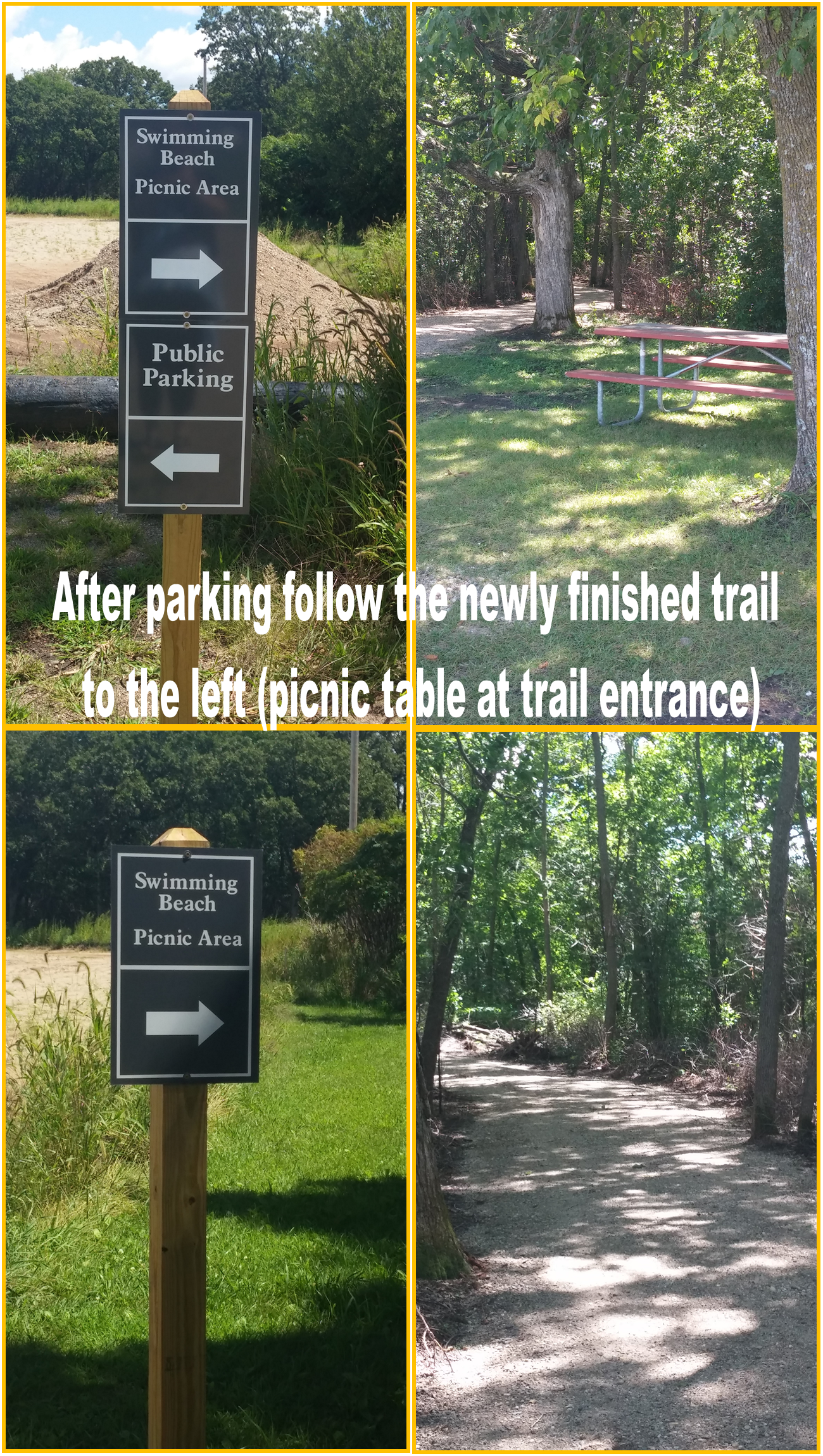
Directions to the Beach!
Beach Parking Update / Walking Trail to Beach: I know there has been some confusion about how to get to the Bertram…
Posted by Friends of Bertram Chain of Lakes Regional Park (YMCA Camp Manitou) on Monday, August 10, 2015

Bertram Lake Beach Now Open!
http://www.sctimes.com/story/news/local/2015/06/05/bertram-lake-swimming-beach-opens-public/28547617/
Posted by Friends of Bertram Chain of Lakes Regional Park (YMCA Camp Manitou) on Tuesday, June 9, 2015
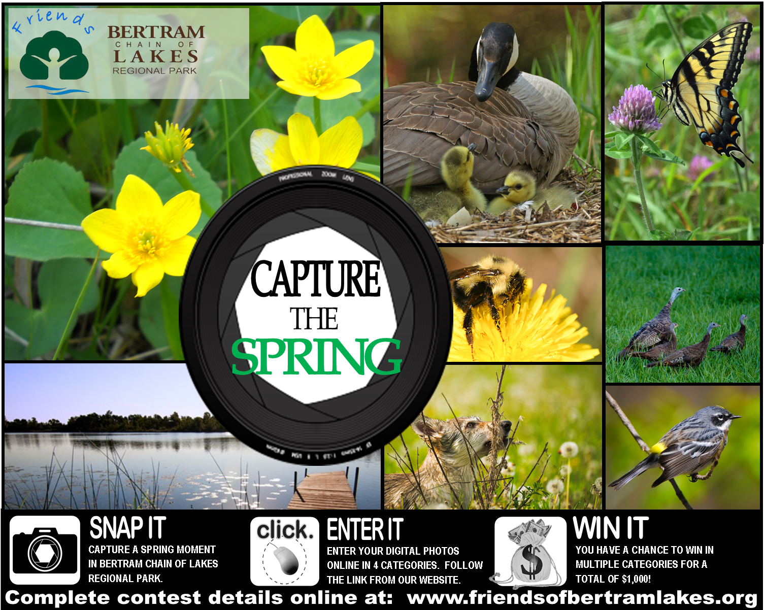
Looking for your Spring Photos!
We’re happy spring is here and we need your Spring Photos for our Capture the Seasons Photo Contest! Please visit…
Posted by Friends of Bertram Chain of Lakes Regional Park (YMCA Camp Manitou) on Thursday, May 7, 2015
SPRING CLEANUP!
Mark your calendars for Spring Cleanup at Bertram ~ Volunteers Needed! Will meet at the South Entrance parking lot at 9 a.m. on Saturday, May 2nd. Email for details at friendsofbertram@hotmail.com. ☼
Posted by Friends of Bertram Chain of Lakes Regional Park (YMCA Camp Manitou) on Monday, April 13, 2015
In the previous tidbit, Farms II, I mentioned that the farmers who owned and operated the Bertram Lakes land were stewards or “trustees” of the land. As we enter the final stages of the purchase of this land, we must remind ourselves of this stewardship. I recently came across a quote that is very fitting for us. It reads as follows:
As we enter our own stewardship, let us remind ourselves that we need to preserve, protect, and improve when we can so that future generations can enjoy the land also.
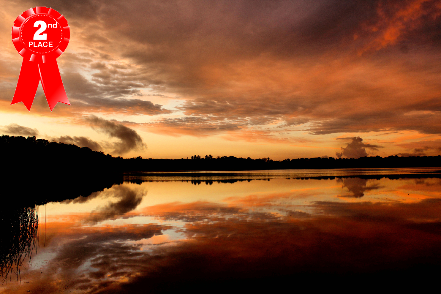
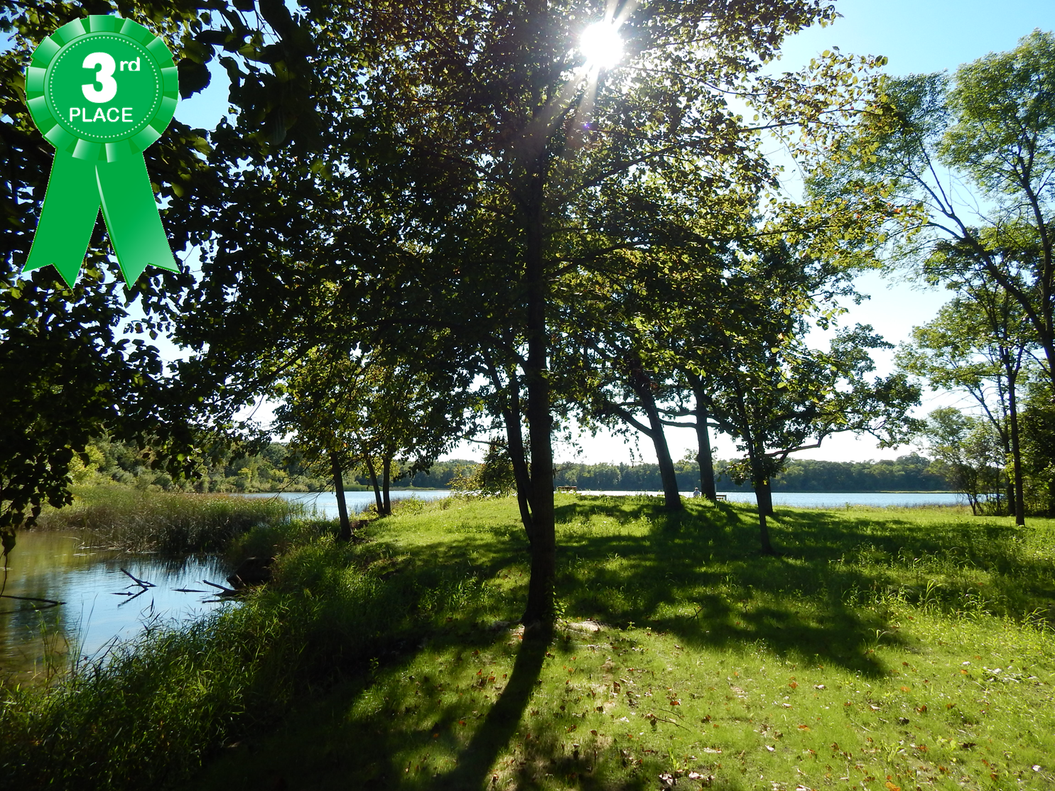
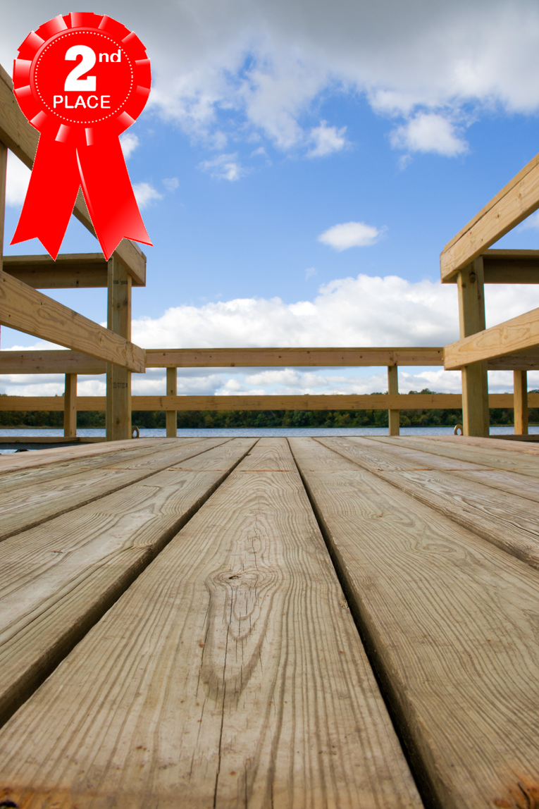
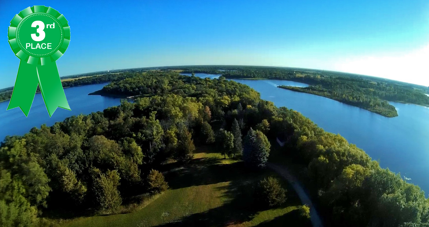
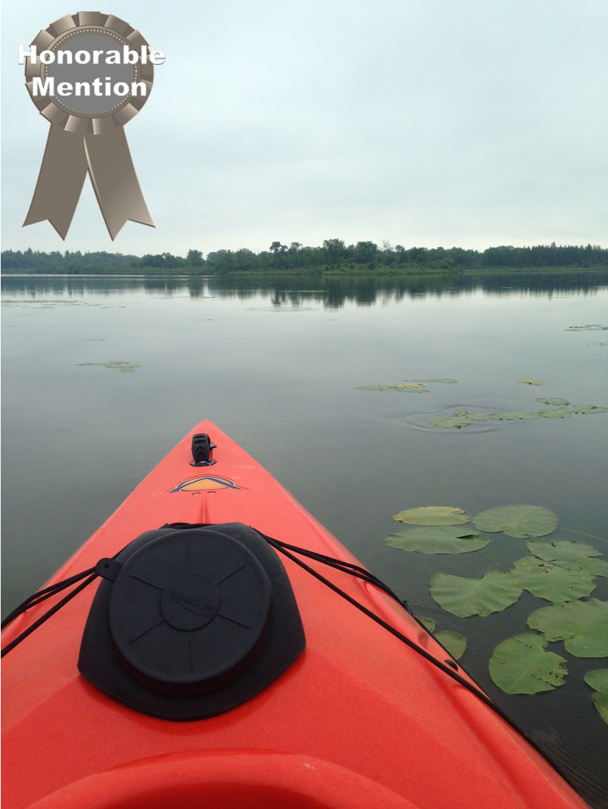
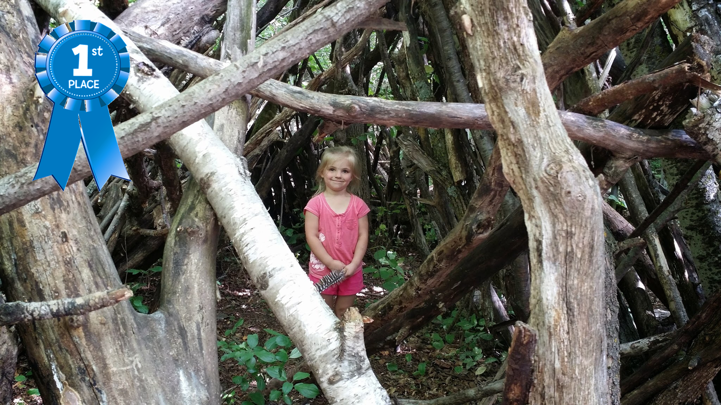
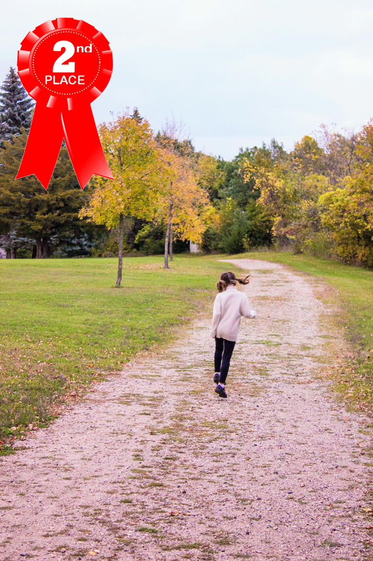
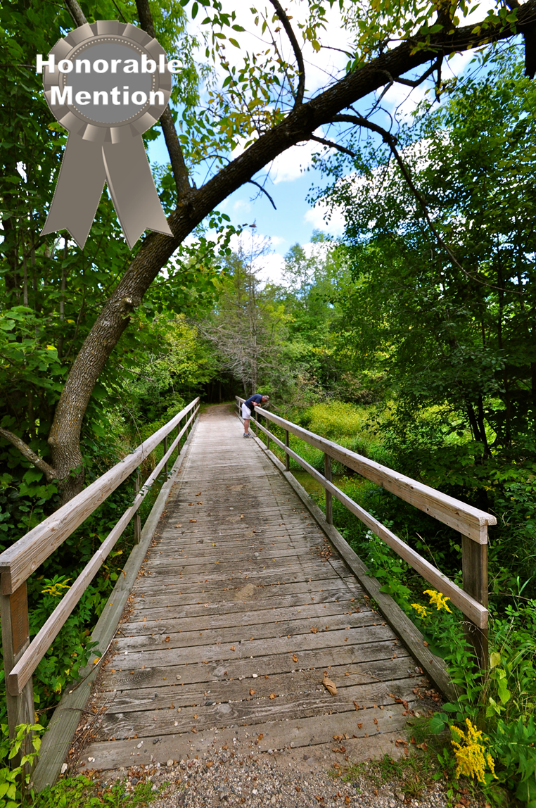
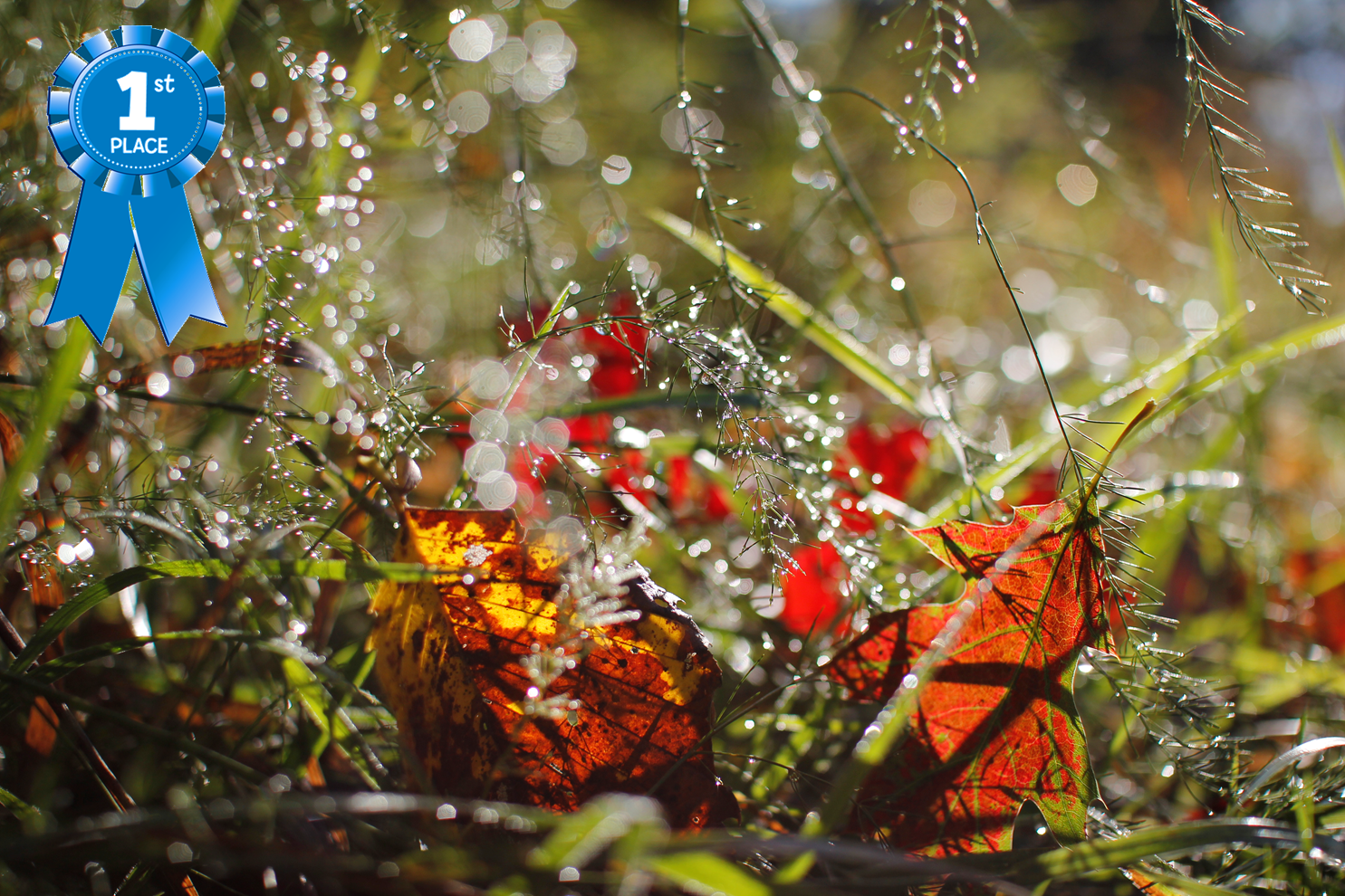
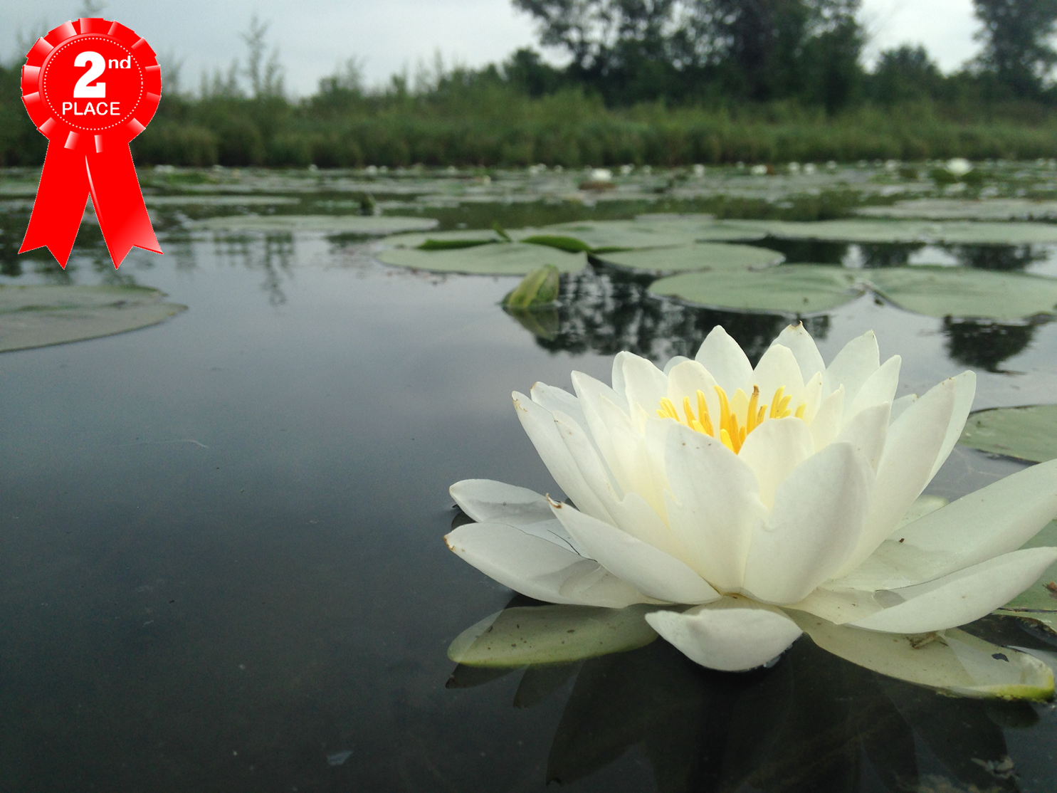
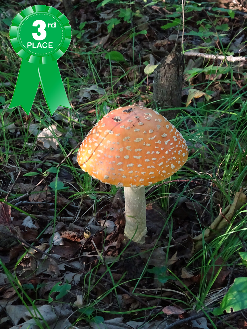
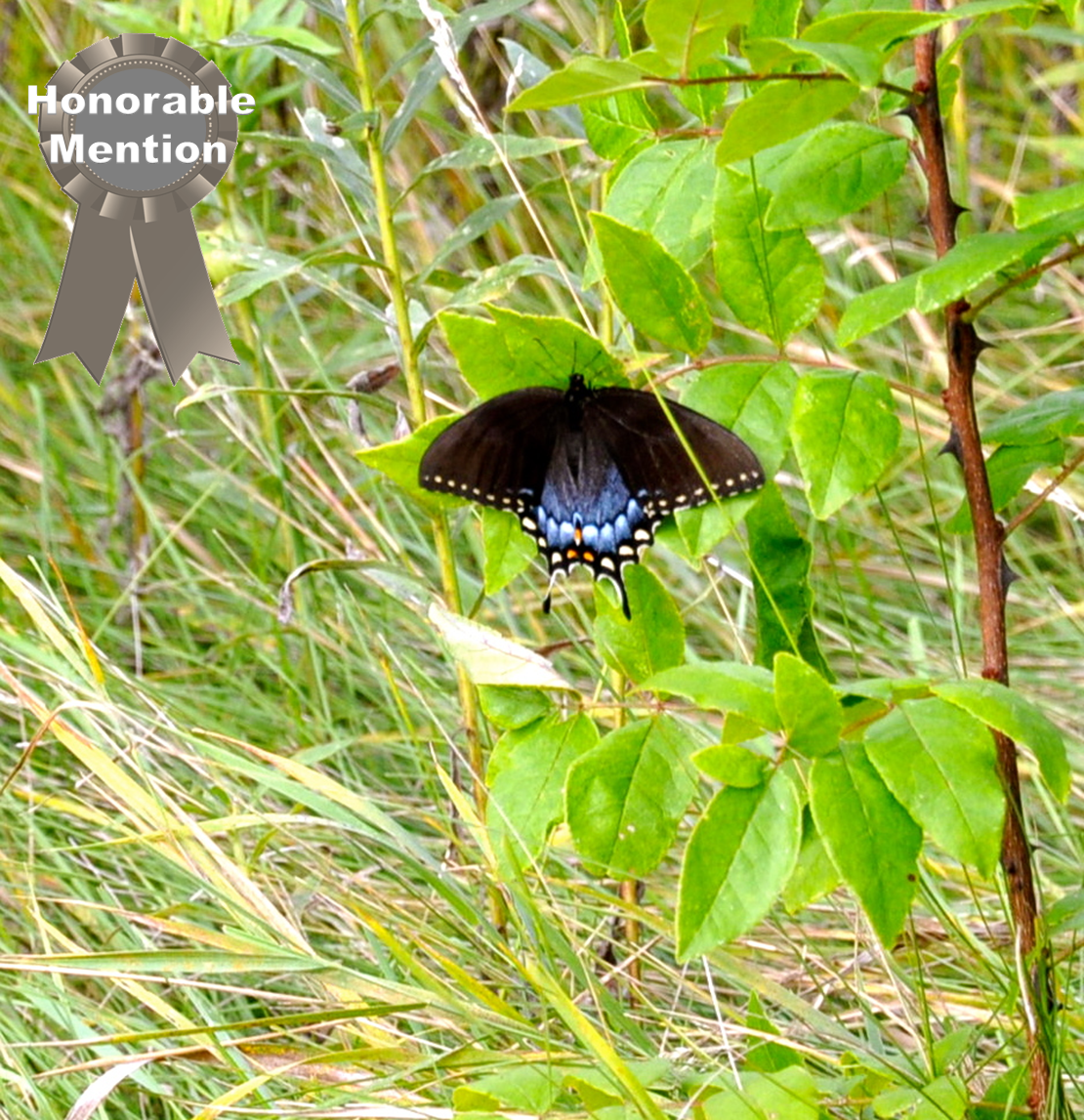
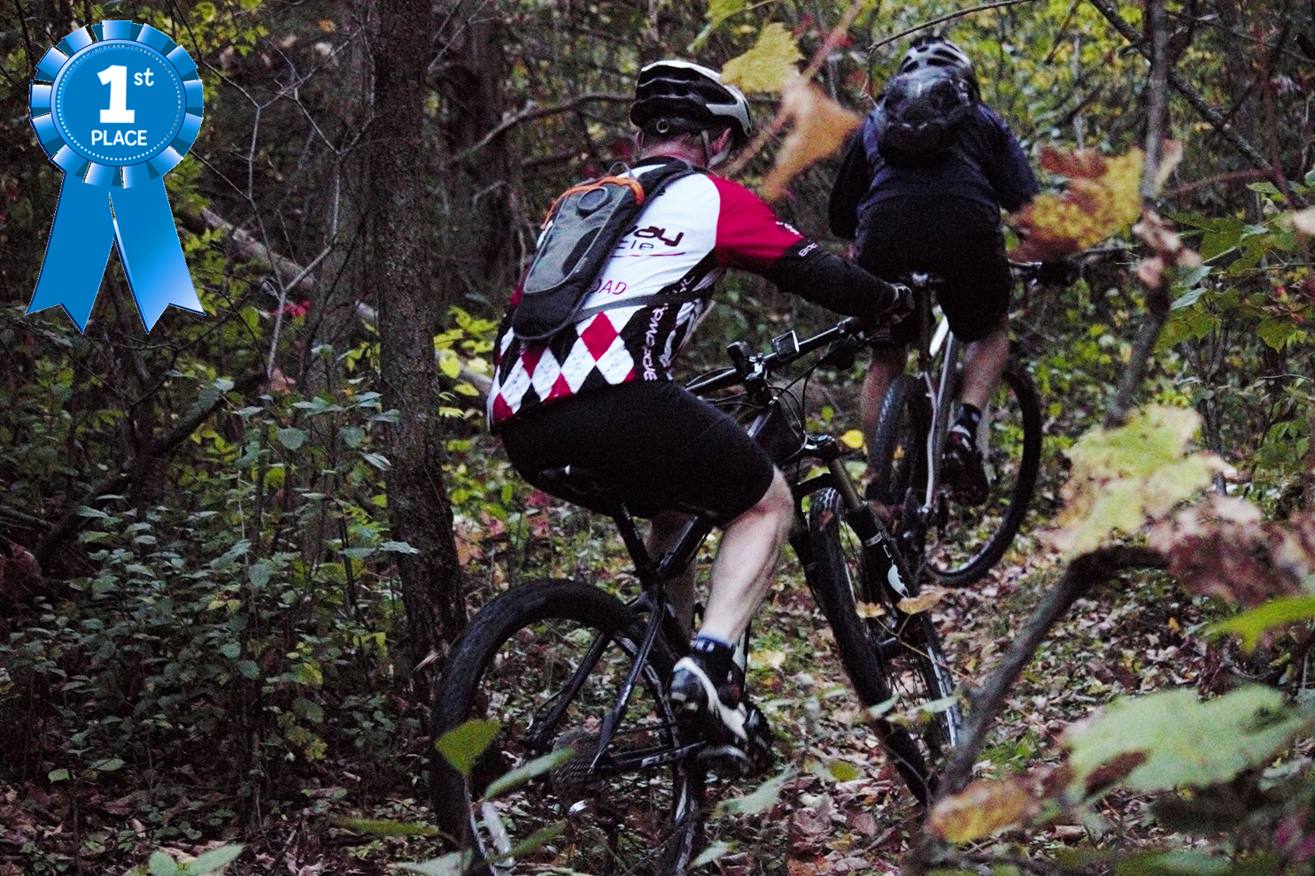
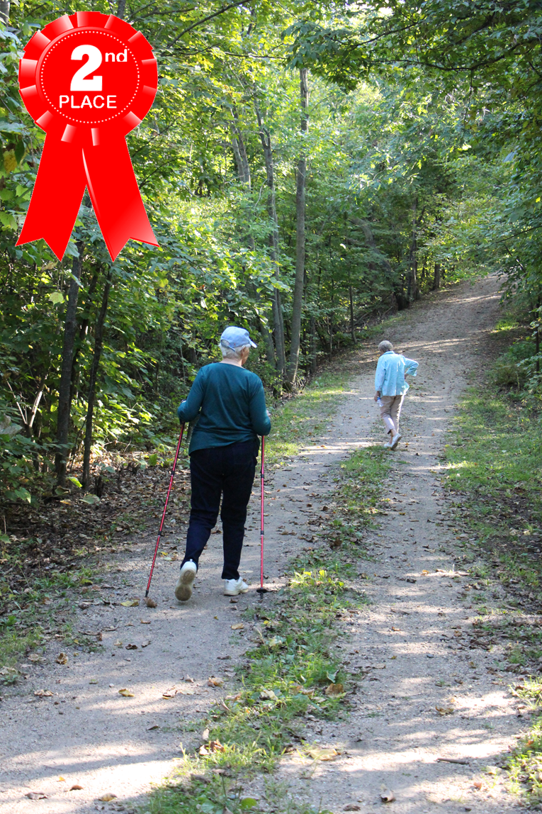
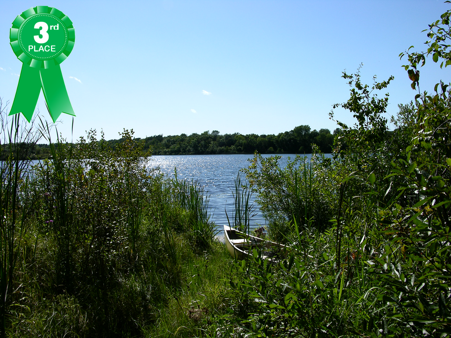
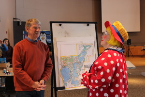
The First Annual Photo Contest was a Success! We received over 60 entries in 5 categories. Many amazing photos were submitted and the judging was extremely difficult but the votes are in and the winners have been announced! Shown below are the winning photos. Click on the tabs in the drop down menu to view all photos submitted in each category!
Thank you to all who participated in this event. We love your photos and are looking forward to making this an annual event!


Our Park Continues to Grow!
A $3.8 million, 164-acre acquisition successfully closed on June 5, 2014, bringing the park total to 721 acres. The purchase was made possible with $2.2 million in grant funding and additional match funding from Wright County and the City of Monticello.
The next acquisition of 80 acres is slated for 2015. The estimated cost is $2.3 million with $1.4 million coming from grant funding.
With the closing of the latest acquisition, the county and city will now own the beach at Bertram Lake and the 12-acre parcel where the YMCA intends to build its new Day Camp Manitou. The YMCA will operate Camp Manitou on the county and city property through the end of the 2014 season and will transition over to their new camp for the 2015 season. The county and city will look into the options for opening the beach to the public after day camp hours. There are many issues that need to be resolved prior to opening the beach; therefore, it is assumed the public opening of the beach will commence in 2015. Furthermore, the city has secured grant funding to begin Phase I of the Athletic Complex sometime in 2015.
Minnesota Off-Road Cyclists (MORC) will continue building the single track mountain bike trails in the park this summer. Currently MORC volunteers are working to reroute and rebuild a 10-mile mountain bike loop open to non-motorized use; however, it is expected that the trails will grow to 14 miles. MORC volunteers work on the trails in the park on Wednesday evenings through the summer. Bertram Chain of Lakes Regional Park is the one place in Wright County that offers mountain biking. The trails are signed and bikers are encouraged to test out the trails. The topography is fun to ride and there are a lot of great switches, so there can be challenging parts!
Once Bertram reaches its planned 1,050 land acres (1,200 acres including water bodies), it will become the largest regional park in Wright County!
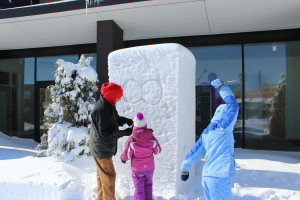
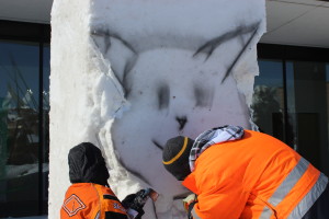
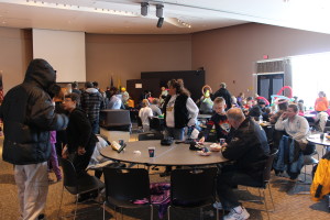
Winter Block Party 2014 a Success!
Thanks to the hundreds of folks who came out for the
1st Annual Monticello Winter Block Party
and
Friends of Bertram Snow Sculpting Event!
Although it was a bit chilly, there were four snow sculptures carved on the front lawn of the Community Center and lots of warm conversation and fun inside the building.
Snow sculptures were judged with cash prizes going to
1st, 2nd and 3rd place winners!
Kids snowman building contest winner received an
MCC Gift Card and Certificate!
This was a great event for introducing and updating the Monticello Community on the growing park and its activities.
Hope to see you next year!


